How to Leverage Accurate Weather Forecasts in Shipping
Insight
- Nikki
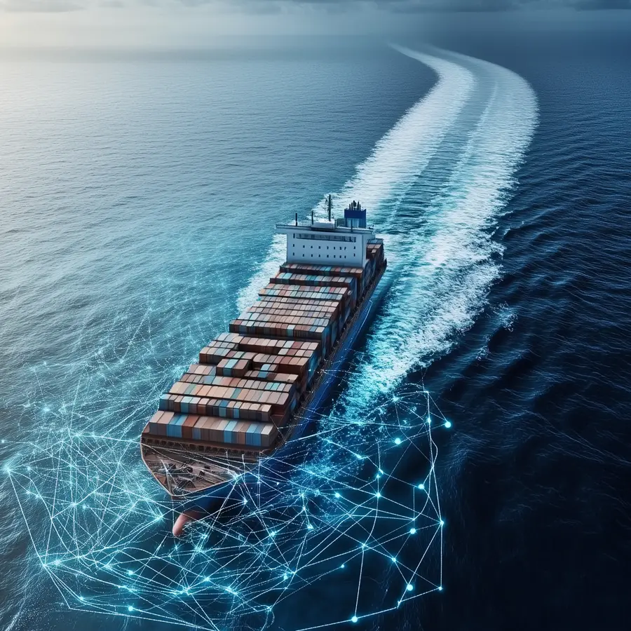
Accurate maritime weather data plays a pivotal role in ensuring the safety, efficiency and profitability of maritime operations. Leveraging weather data, or metocean data, seafarers can navigate safely and make informed decisions, such as altering course to avoid bad weather or choosing the best route to take advantage of favorable conditions. With advancements in technology, the quality and precision of weather forecast shipping have significantly improved.
Types of Metocean Data
- Wind Data: Depending on the direction, windy conditions can either aid or hinder a vessel’s journey. Thus, wind data is an essential component in numerical weather predictions.
- Wave Data: Rough sea conditions can negatively affect a ship’s efficiency and safety. Wave data, which is often correlated with wind data, helps in predicting the sea state that a vessel might encounter. This data is critical for optimising weather forecast shipping plans to ensure the safety of the crew and cargo.
- Ocean Currents: While often not dangerous by themselves, ocean currents are vital for any ship optimisation calculation. Insight into ocean currents can lead to more efficient routing and fuel savings, a key element in metocean forecasts.
- Temperature and Precipitation: Temperature and precipitation data are used to forecast weather that may affect the transport of bulk cargo and reefer containers. This data is critical for ensuring that cargo is transported under optimal conditions, supporting the best weather forecasting practices.
How is Maritime Data Collected?
Maritime weather data can be obtained from various sources, such as satellites, buoys, vessels, and ground stations. Advanced numerical weather prediction (NWP) models integrate data from all these sources to provide comprehensive forecasts. Commercial companies or government agencies like NOAA and the UK’s Maritime & Coastguard Agency (MCA) distribute this data, providing maritime weather forecasts and alerts to the public. The following sources are most commonly used:
- Satellites: Satellites are a primary data source, providing extensive coverage of oceans and remote areas. They use various remote sensing technologies to measure atmospheric and oceanic conditions. Critical for developing accurate weather forecasts.
- Weather buoys: collect data from the ocean directly as they lie directly in either oceans or lakes. They can measure a range of weather conditions, such as wave height, swell period and direction, wind speed, current and surface temperature. They are efficient in providing localised data, but because they are mostly stationary, it limits their ability to provide a comprehensive coverage over extensive oceanic areas.
- Ground Stations: Land-based facilities equipped with various meteorological instruments. They measure atmospheric conditions, such as temperature, humidity, air pressure, wind speed, and wind direction. Coastal ground stations also gather oceanographic data like sea surface temperature and wave conditions. Ground stations provide highly accurate and continuous local data. They provide long-term monitoring capabilities and play an essential role in validating satellite and buoy data. However, their limitation to coastal areas results in missing open ocean weather data.
- Vessels: Ships and other maritime vessels equipped with meteorological instruments can collect weather data as they travel. Vessels can cover sizeable areas of the ocean, providing valuable in situ data along their routes. Data collection is route-dependent though and may be irregular because of the operational priorities of the vessel.
- Weather Balloons: Launching from ground stations and coastal areas, weather balloons, also known as radiosondes, collect high-altitude atmospheric data. They measure temperature, humidity, pressure, and wind speed/direction as they ascend through the atmosphere. They can provide detailed vertical profiles of the atmosphere, which are crucial for understanding weather patterns and improving forecast models. However, they can only be released on land, limiting open ocean weather data.
The Superiority of Spire Satellite Weather Data
Low Earth Orbit (LEO) satellites orbit the Earth at altitudes between 200 and 2,000 kilometers, providing a unique advantage compared to other weather data collection. Spire, a leader in satellite data, uses a constellation of >100 LEO satellites to gather high-resolution weather data, which significantly enhances the accuracy and reliability of weather forecasts in shipping. Recognised by NOAA for their most accurate radio occulation measurements, Spire’s weather data offers the following advantages:
- Comprehensive Coverage: LEO satellites cover the entire globe, including remote ocean areas and polar regions, often inaccessible. LEO satellites’ global coverage benefits the maritime industry by ensuring that no part of the ocean goes unmonitored. Comprehensive coverage allows for better tracking of weather systems and improved forecast accuracy across all maritime regions.
- High Resolution Data: The radio occultation technique used by LEO satellites offers high-resolution data on atmospheric conditions. This technique measures atmospheric parameters by analysing how radio signals bend as they pass through the Earth’s atmosphere. Providing detailed profiles of atmospheric conditions from the Earth’s surface through the stratosphere and into the upper atmosphere. 10,000 radio occultation measurements are made daily, significantly improving weather forecasts.
- Frequent Updates: Due to their lower orbits, LEO satellites have shorter orbital periods, enabling them to revisit specific locations more frequently. This frequent revisit capability ensures that weather data is updated more regularly, providing near real-time information. Timely updates are essential for maritime weather forecasting to make informed and quick decisions in response to changing weather conditions.
Why are Accurate Maritime Weather Forecasts Important?
In 2023, the World Shipping Council reported that approximately 661 containers, valued at more than $7 trillion, were lost at sea due to bad weather. Out of the total 26 ship losses, 8 vessels reported extreme weather conditions to be a major factor. Technological advancements that optimise marine weather forecasting, such as radio occulation, help prevent sailing in severe weather and prevent these types of damages. By leveraging the most superior weather data with over 10.000 weather data points per day, Proseadure’s weather application can enhance the following:
- Safety: Accurate metocean forecasts can prevent sailing in dangerous conditions such as tropical cyclones, severe thunderstorms and rough seas which can lead to significant damage to vessels and cargo, and even loss of life. To ensure operators avoid dangerous weather conditions in time, Proseadure sends real-time weather alerts via e-mail or WhatsApp.
- Fuel Efficiency: Accurate maritime weather data enables ship operators to optimise their routes, avoiding bad weather that can lead to increased fuel consumption. By using our multi-objective voyage optimisation module, which includes the most accurate weather forecasts, operators will always follow the most optimised route for both fuel efficiency and safety as well as the desired time of arrival.
- Cost Savings: One of the indirect consequences of avoiding bad weather, is reduced costs associated with insurance claims, damages and operational efficiencies. Proseadure, also offers their post-voyage analysis module that can verify charterers’ claims about increased fuel usage due to bad weather. If the analysis shows mismanagement rather than bad weather conditions, ship owners can avoid unjustified costs, resulting in significant savings.
- Compliance: International maritime regulations often require vessels to adhere to specific weather-related guidelines to ensure safety and environmental protection. Access to reliable weather data ensures that maritime operators can comply with these regulations, avoiding penalties and maintaining good standing with regulatory bodies. Use Proseadure’s compliance module to help you with automatic environmental compliance.
- Environmental Friendliness: Leveraging accurate and reliable maritime weather data helps the shipping industry become more environmentally friendly by achieving a lower CII rating due to lower emissions by avoiding bad weather.
Interested to learn how our weather forecasts can help your operations? Book a demo with our experts today.
Newsletter
Subscribe to our newsletter for the latest news and insights
Latest News


Learn how Proseadure can steering your company towards sustainability
Latest news
Steering Towards Sustainability: Innovating Vessel Software for a Greener Tomorrow
- Nikki
FuelEU Maritime is the latest regulation soon to be adopted in the industry. Here’s a comprehensive guide.

- Nikki
Accurate maritime weather data plays a pivotal role in ensuring the safety, efficiency and profitability of maritime operation